
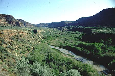
From the Hard-To-Believe File: a little over one month ago I wrote about preparing my 1960s travel trailer for evacuation in Utah’s extreme heat. In the last week, I received many National Weather Service Flash Flood Emergency Alerts via cell phone. Jarring disaster tones screeching from my pocket are new; summer flash floods are not. On July 29, 1883, Kanab residents watched a flood rip, in one afternoon, the meandering, crop-level Kanab Creek a new home: the 90-foot-deep, cliff-walled arroyo we know today. This caused, ahem, a few problems for those who ate only what they could grow. Not only was most of their year’s crop (and its field) on course for Grand Canyon, but also there would henceforth be a bit of a problem irrigating whatever was left, given the crops were now perched 90-feet above the stream. Thus ensued hundreds of years of erecting dams, digging ditches, and cursing, well, whatever was and is cursed.
This cycle of arroyo cutting and filling has been repeated every few millennia depending on rain and whether sediments are washed away or build steadily over time. Rain is most likely tied, as in the 1883 storm, to El Nino events. There was another Southwestern erosional cycle ca. 1200-1300, which may have contributed in the same way to Puebloan abandonment. And if it doesn’t stop raining soon this year, I may be moving to the DRY Tortugas.
